

Río Celeste Hike: Why I Would Go Beyond the Waterfall
Río Celeste looks almost fake in photographs, but what surprised me most when I hiked through Tenorio Volcano National Park was that the famous waterfall was only one part of the experience.
I started early with mist still hanging over the rainforest, descended toward the turquoise waterfall, continued past volcanic gases and blue pools, crossed deeper into the forest and eventually reached Los Teñideros, where two ordinary-looking streams meet and the water visibly begins turning blue.
This guide is built around that complete hike rather than a quick waterfall photo stop: the current trail status, ticket rules, real difficulty, weather, Teñideros, wildlife, where to stay, whether you need a guide, and the best way to fit Río Celeste between La Fortuna and Guanacaste.
Updated October 2026. Trail access can change after heavy rain, landslides or maintenance. Some links below are affiliate links, which means I may earn a commission if you book through them at no additional cost to you.

Walk to the waterfall area, take your time at the viewpoint and return. This works if your mobility or schedule makes the full trail impractical.
The waterfall is spectacular, but Teñideros, Laguna Azul, Borbollones and the rainforest make the hike much more interesting.
This makes particular sense from the Guanacaste coast when transport, wildlife spotting and additional waterfalls can be combined.
Río Celeste remains open, but recent 2026 information indicates that access on the lower part of the waterfall staircase has remained restricted following earlier closures. You can still see the waterfall, but check the latest park notice immediately before visiting rather than assuming every section shown in older photographs is accessible.
Río Celeste Trail Facts for 2026
Several practical details in older Río Celeste guides are now outdated.
Tickets are sold through Costa Rica’s official SINAC reservation system and should be booked in advance.
I would choose an early morning slot. The trail is cooler, wildlife tends to be more active and you leave yourself far more room if muddy conditions slow you down.
The official Sendero Misterios del Tenorio is roughly 3 km (1.9 mi) one way. Once you include the return and waterfall spur, the complete hike is roughly 6–7 km (3.7–4.3 mi).

Want Río Celeste Plus Wildlife and Another Waterfall?
A combined nature day makes much more sense than paying for transport simply to photograph Río Celeste and drive straight back.

Río Celeste Hiking, Sloth Sanctuary & Llanos de Cortés Waterfall Tour
This tour combines three experiences that are awkward to stitch together efficiently without a car: Río Celeste and Tenorio’s rainforest, a wildlife stop focused on sloths, and Llanos de Cortés Waterfall.
I particularly like the route for travelers based on the Guanacaste side of Costa Rica who want a substantial inland nature day rather than organizing several separate transfers.
Do Not Treat the Waterfall as the Finish Line
The farther section is where Río Celeste changes from a waterfall stop into a volcanic rainforest hike.
I started shortly after 8:00 AM with fog still hanging over the canopy.
Hummingbirds moved through the vegetation near the entrance, the air smelled of wet earth and the trail disappeared almost immediately into dense forest.
The opening stretch is not particularly intimidating, but Tenorio’s humidity changes the character of the walk. Roots become slick, mud builds quickly after rain and sections that look easy on paper can take longer than expected.

El Pilón Entrance → Waterfall Junction
The route begins through thick rainforest before reaching the waterfall spur after roughly 1.5 km (0.9 mi).
Río Celeste Waterfall
Follow the staircase as far as current access allows, enjoy the waterfall and then return to the main trail rather than automatically heading back to the entrance.
Mirador & Laguna Azul
This is where the trail begins revealing the volcanic landscape beyond the famous cascade.
Borbollones
Sulfurous gases, bubbling water and geothermal activity remind you that you are hiking on the slopes of an active volcanic complex.
Los Teñideros
This is where two clear streams meet and the famous Río Celeste color visibly begins.

Río Celeste Waterfall Really Is That Blue
The photos are dramatic, but the color did not disappoint me in person.
I could hear the waterfall well before I could see it.
Then the forest opened and the river dropped roughly 30 m (98 ft) into a turquoise pool framed by dense green vegetation.
It is the sort of color that initially makes you wonder whether every photograph online has been pushed too far in editing.
Mine had not.

Swimming is prohibited inside Tenorio Volcano National Park. That applies to the waterfall pool and the other blue-water sections along the official trail.
If a tour advertises swimming in Río Celeste, read the itinerary carefully. Swimming activities normally take place on accessible stretches of the river outside the protected national park.
Los Teñideros Is the Scientific Payoff of the Hike
This is the reason I think turning around at the waterfall means missing part of the Río Celeste story.
At Los Teñideros, two clear streams converge.
The blue is not caused by dye, algae or a blue mineral dissolved in the water. When the streams mix, their different chemical conditions cause naturally occurring aluminosilicate particles to aggregate to a size that scatters blue wavelengths of light especially efficiently.
In simple terms, the river looks blue because the mineral particles scatter light.
Watching that transition happen where the streams meet gave the hike much more meaning for me than simply arriving at a photogenic waterfall.
Costa Rican folklore offers the better story: after painting the sky, God supposedly washed the blue from his paintbrush in the river.

Borbollones: Where the Jungle Starts Hissing
Borbollones was one of the moments when the volcanic nature of Tenorio became impossible to ignore.
Gas bubbles through the riverbed, steam escapes through cracks and the smell of sulfur hangs in the damp air.
What makes it unusual is that you are not walking across an exposed barren volcano. You are inside thick tropical forest while geothermal activity appears through the vegetation.
Stay behind barriers. Hot water, unstable ground and volcanic gases are not something to approach for a better photograph.
Laguna Azul
Less spectacular than the waterfall, but one of the trail’s most peaceful stops.
Laguna Azul is a calm blue pool surrounded by dense rainforest.
I stopped here longer than I expected. A snakebird stood at the edge with its wings spread while most hikers continued toward Teñideros.
After the roaring waterfall and geothermal activity, the stillness felt almost strange.

Best Time to Hike Río Celeste
The useful answer is more nuanced than “dry season good, rainy season bad.”
December–April
The drier season generally gives you the highest probability of easier trails and consistently vivid blue water.
It is also the busiest period, which makes an early reservation even more worthwhile.
May–November
The rainforest is intensely green, but mud and heavy rainfall become more important.
Río Celeste can still look spectacular during green season. The bigger issue is whether recent heavy rain has loaded the river with sediment.
Wildlife at Tenorio Volcano National Park
Río Celeste gets the publicity, but the rainforest around it was one of the best parts of my visit.
I saw coatis moving through the undergrowth, toucans high in the canopy, a sloth almost disappearing into the branches, butterflies and frogs around the wetter sections.
I even encountered a viper resting on vegetation beside the trail.


Larger mammals including tapirs, pumas and jaguars occur in the wider protected landscape, but seeing them on a normal daytime Río Celeste hike would be exceptional.
If wildlife is one of your priorities, this is the main reason I would consider a guide. You do not need one for navigation, but trained eyes are much better at finding motionless sloths, snakes, frogs and birds in dense tropical vegetation.
Tenorio’s Rainforest Is Part of the Hike
Ferns, bromeliads, vines, mosses and epiphytes cover almost every available surface.
Heliconias add sudden flashes of red and yellow while large rainforest trees close the canopy overhead.
The air becomes cooler and heavier as the trail moves through wetter forest, and the vegetation helps create the sense that each section belongs to a slightly different ecosystem.

The wet volcanic vegetation reminded me of other island and mountain environments I have explored, especially Cilaos in Réunion and the waterfall-rich eastern side of São Miguel in the Azores.
The Río Celeste Hike Is Moderate — Mud Is the Wild Card
I would not call Río Celeste technically difficult for someone with normal fitness.
There is no major summit climb and the distance is manageable.
What changes the hike is the combination of:
- uneven roots and stones;
- mud after rain;
- high humidity;
- the waterfall staircase;
- slippery wooden and stone surfaces;
- and stopping constantly for the scenery and wildlife.
Waterproof shoes with good grip matter much more here than expensive technical equipment.
During very muddy periods, rubber boots available around the entrance can be genuinely useful.
Bijagua, La Fortuna or Liberia?
The hike stays the same. The logistics around it do not.
Bijagua
My preferred base if Tenorio is a priority. Stay nearby, enter early and avoid beginning the day with a long drive.
La Fortuna
Roughly 1.5–2 hours away by road. Sensible if Río Celeste is one day within a broader Arenal itinerary.
Liberia / Beach Coast
Usually around 1.5–2 hours depending on the exact starting point. This is where the guided full-day option becomes particularly attractive.
Driving to Río Celeste
Driving is the easiest independent option and gives you the most flexibility.
The principal access roads to the national park are paved, so you do not need a 4WD simply to reach the official Río Celeste entrance.
A higher-clearance vehicle may still make sense if Tenorio is one stop in a larger Costa Rica road trip that includes rougher secondary roads.

Compare Rental Cars for Your Costa Rica Route
Having your own car makes it easy to sleep around Bijagua, enter Tenorio early and then continue toward La Fortuna or Guanacaste without building the day around transfers.
Can You Reach Río Celeste by Bus?
Not directly.
Public buses can get you to Bijagua, but there is no regular public bus that simply deposits you at the national park trailhead.
From Bijagua, arrange a taxi or transfer for the final section. It is possible, but substantially less efficient than having a rental car or taking an organized tour.
Tenorio Volcano National Park Map
Where to Stay Near Río Celeste
If Río Celeste matters to you, I prefer staying around Bijagua or Tenorio rather than spending the first part of the morning driving from farther away.

Hideaway Rio Celeste Hotel
The higher-comfort option, with secluded rainforest casitas, pool, spa, wildlife around the property, on-site dining and easy access to Tenorio.
Check Rooms & Prices
Celeste Mountain Lodge
A greener lodge-style base with jungle views, pool and on-site dining, well suited to travelers who want to stay immersed in the Tenorio landscape.
Check Rooms & Prices
Hana’s Celeste Retreat
A more intimate, family-run option with simple rooms, warm hospitality and a peaceful setting near the Tenorio area.
Check Rooms & Prices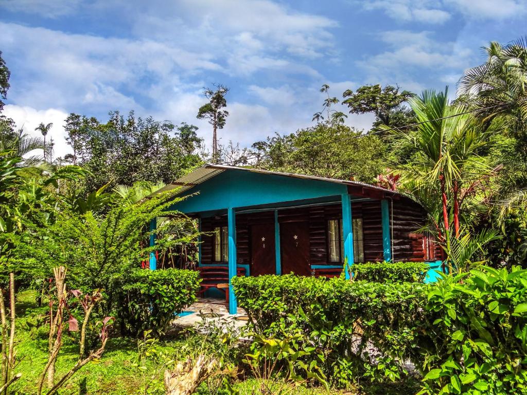
Posada La Amistad
A straightforward local base with clean rooms and an attached soda, useful if you want to stay close without paying eco-lodge prices.
Check Rooms & PricesCamping & Eating Around Río Celeste
Camping Near Río Celeste
Travelers looking for a simpler stay can also find small camping options in the wider Bijagua area.
- Villa Celeste Katira: simple camping in a natural setting.
- Poza del Pedro: a rustic riverside option.
- Doña Ana: a small family-run camping experience.
Even in warmer months, expect damp nights and come prepared for rain.
Where to Eat
I would eat a proper breakfast before entering the park and plan lunch afterward rather than depending on food during the hike.
- Soda La Amistad: convenient Costa Rican food and associated with Posada La Amistad.
- Tilapiera Los Laguitos: a relaxed option for local fish.
- Restaurant Tapirus Paradise: useful when you want a broader sit-down menu.

Mobile Data Around Río Celeste
Expect useful service around towns and lodges, but not uninterrupted coverage deep inside the rainforest.
Mobile coverage around Bijagua and the park approach is much more useful than it is deep inside Tenorio.
Download your navigation, accommodation details and ticket information before hiking rather than depending on a live signal once you are on the trail.

Costa Rica eSIM
If you want mobile data ready before landing, Nomad offers prepaid Costa Rica eSIM plans that can be installed before your trip.
An eSIM cannot create signal where the underlying Costa Rican network has no coverage, so offline navigation still matters around rainforest and mountain areas.
Check Nomad Costa Rica PlansIf Costa Rica is part of a longer Central or South America trip, compare regional options in my Latin America eSIM guide instead of automatically buying a new plan for every country.
What To Pack for Río Celeste
- Waterproof hiking shoes: probably the most useful item.
- Rain jacket or poncho: worthwhile even during the drier months.
- Reusable water bottle: bring enough for several humid hours outside.
- Dry bag or waterproof phone pouch: tropical rain can arrive quickly.
- Insect repellent: especially useful around damp forest.
- Binoculars: worth bringing if wildlife matters to you.
- Offline maps: download everything before entering the park.
- Basic first aid: particularly blister treatment and anything you normally use while hiking.
Is Río Celeste Worth Visiting?
Yes — but I think the strongest experience is considerably better than the standard “drive in, photograph the waterfall, drive out” itinerary.
What stayed with me was the sequence.
Rainforest first. Then the waterfall. Then sulfur and geothermal activity. Then intensely colored pools. Wildlife appearing when I slowed down. And finally Los Teñideros, where the entire visual mystery of the river suddenly made scientific sense.
That combination is why Río Celeste stands out even in a country full of rainforest and waterfalls.
If volcanic hiking is your thing, you may also enjoy my guides to Sete Cidades in the Azores and Pico Island. For another lush waterfall landscape, my Cilaos hiking guide for Réunion and Nordeste guide for São Miguel are natural follow-ups.
Río Celeste Hike FAQ
How long is the Río Celeste hike?
The main park trail is about 3 km (1.9 mi) one way. With the return journey and waterfall detour, expect roughly 6–7 km (3.7–4.3 mi) in total depending on current access.
How long does Río Celeste take?
Most travelers should allow around three to four hours for the complete route, or longer if you stop frequently for wildlife and photography.
Is the Río Celeste hike difficult?
I would rate it moderate. The distance and elevation are manageable, but mud, roots, humidity, slippery surfaces and the waterfall staircase make it more tiring than a simple forest walk.
Can I hike Río Celeste without a guide?
Yes. The main trail is straightforward and you do not need a guide for navigation. A guide is most valuable for wildlife spotting and interpreting the park’s ecology.
Can you swim at Río Celeste?
Swimming is prohibited inside Tenorio Volcano National Park. Some tours use swimming areas on accessible sections outside the protected park boundary.
Is the Río Celeste waterfall staircase open?
The waterfall remains visible, but parts of the staircase have been subject to restrictions following earlier closures. Check the current SINAC or park notice immediately before traveling because access can change.
Do Río Celeste tickets need to be booked in advance?
Yes. Tenorio Volcano National Park uses online reservations through Costa Rica’s SINAC system. I recommend choosing an early entry time.
What is the best time to see Río Celeste blue?
The drier months from December through April generally give you the best chance of vivid water and easier hiking conditions. Heavy rain shortly before your visit can temporarily introduce sediment and mute the blue.
Do I need a 4WD for Río Celeste?
No, not simply to reach the official national park entrance. The principal access roads are paved. Choose a 4WD if other sections of your Costa Rica itinerary require one.
Should I stay in Bijagua or visit from La Fortuna?
If Río Celeste is one of the priorities of your trip, I prefer Bijagua because you can start early without a long morning drive. La Fortuna works well when Tenorio is one day within a broader Arenal itinerary.
Why is Río Celeste blue?
At Los Teñideros, two clear streams with different chemical characteristics mix. That interaction causes naturally occurring mineral particles to aggregate to a size that scatters blue light very effectively, producing the turquoise appearance.

Last Updated on 06/10/2026 by Panos